Snowshoe Zen at the Great Saint Bernard Pass
In an earlier story I had been praising the area around the Swiss-Italian Great Saint Bernard Pass as an easily accessible alpine wonderland – between June and October that is, when the pass road is open bringing you conveniently up to some 2500 meters above sea level to head-start exploration.
For the rest of the year snow closes the way towards the pass to cars – but not to determined ski and snowshoe hikers. In fact, the wider Grand-Saint-Bernard area sports one of the most extensive networks of winter trekking routes in Switzerland. For starters, however, let us just have a look at the basic ascent from the parking lot next to the barrier that closes off the road to the pass in winter up to the Col du Grand-Saint-Bernard with its small collection of sturdy Swiss gingerbread houses the main one of which, the L’Hospice du Grand-Saint-Bernard, is inhabited year-round by a small group of monks.
Planning is not optional
Hiking in the high Alps always carries some residual risks, but realistically those are a lot smaller in summer when other humans are (relatively) plentiful, temperatures are benign and daylight is abundant. In winter, you need to be a lot more careful before you get going.
The most important planning aspect is the weather. Check the hourly forecast on relevant sites (like wetter.com) up until you head off for your little winter adventure. I find it best to pass up a sunny day right after a few days of snowfall (although others recommend to let the fresh snow sit there and get compacted by other wanderers and skiers for another day or so, for safety reasons). Stomping through the glitter of pristine, powdery snow is just a lot of archaic fun. Usually, as you head up towards the pass, temperatures drop and the condition of the snow approaches that powdery ideal, by the way, so do not be disheartened when it is more icy or lumpy at the beginning of the walk.
Apart from the weather, also check the avalanche forecast. For Switzerland you can have a look at the site of the Swiss Institute for Avalanche and Snow Research. I avoid areas classified in the highest avalanche categories, marked red or red with black hatching, but you have to obviously make your own call on the risk you are prepared to accept.
In the ‘good-to-know’ info box at the end of this article I have estimated the time to head up as three hours and the return to base as two hours. This will be true for a person of average physical fitness and allows for plenty of time for breaks. Remember that in winter the sun can set as early as 16:30 and plan your hike accordingly. Set aside at least one hour to be spent at the height of the pass to rest, warm up and enjoy your achievement.
What to take
Well, obviously you need snowshoes. The winter hike from Bourg-Saint-Bernard to Col du Grand-Saint-Bernard is rated in the lowest difficulty category by the Swiss Alpine Club and I have seen a lot of people of all ages and shapes making it up to the Col even with rather flimsy looking snowshoes. If you hire your snowshoes in one of the mountain towns on the way from Martigny to Bourg-Saint-Bernard, the store keeper will pick one that is suitable for your weight. The heavier you are, the larger the snowshoes must be for you not to sink in too far. Remember that a snow cover of two to three meters is common during winters in the Grand-Saint-Bernard region.
You can reuse your summer trekking poles by simply changing their snow baskets to a bigger size to give them a good grip on a lose, snowy surface. Extendable poles are best – I will come back to that later.
Temperatures of -10º C and lower are common in winters around Great St. Bernard. Chose your clothes accordingly and also keep in mind that you are moving through the shady Northern reaches of the Alps and that the chill effect of wind is not to be underestimated. After all the ‘Col’ is a pass i.e. a gap in a mountain range and can act like a wind canal. In any way, thermal winds are likely and you have to be prepared for them. Bring proper gloves, a warm cap or at least a headband and a scarf to wrap around the lower part of your face to warm up the air before breathing it in. Make sure your jacket has a hood.
Sunglasses are a must, at least for me as I get blinded by the glare of blazing sun on a white snow surface within a few minutes. Without sunnies my eyes start hurting and I simply cannot make out shapes in the overwhelming whiteness.
It is mandatory to also mention basic safety equipment for avalanches, the humble snow shovel and high tech avalanche transceivers, for the worst case of getting hit by an avalanche.
The snowshoe experience
Walking on snowshoes is not much different from walking in general although you may have to walk a bit broader, so that the shoes do not keep bumping into each other …
… so finally we are on our four-kilometer way to the Col du Grand-Saint-Bernard. Starting from the car park at Bourg-Saint-Bernard (coordinates below) the first few hundred meters guide you along a wide left bend which is basically following the pass road that is now buried by meters of snow. This stretch is often protected from wind and can make you think that you are overdressed. Well, wait until the end of that curve and you are likely to be hit by an icy wind and arctic snow drift from the deep frozen peaks of the Saint-Bernard range. The windy conditions will prevail for at least half-an-hour until you reach a strange mushroom-shaped concrete structure which is part of the hydroelectric infrastructure in operation in the area. Reaching the concrete mushroom means that you have covered about one third of the distance.
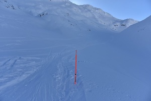
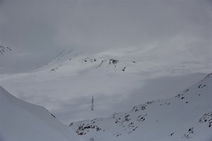
Initially the path is well trodden, broad and easily made out, but this, too, changes starting around that big mushroom. From now on follow the poles and do not deviate too far from them. Some poles are large wooden ones (apparently very old) which look like crooked, barren trees, but the majority are orange or blue plastic markers which have been placed to guide tour skiers and snowshoe hikers.
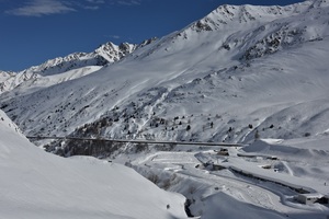
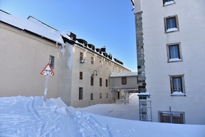
- Access road to the Swiss end of the St. Bernard tunnel (c) nupursworld.com
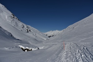
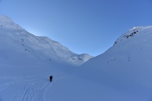
- Looking back at the valley (c) nupursworld.com
- Cannot be overlooked: a pole marking the ascent to the Great St. Bernard pass (c) nupursworld.com
- Some of the ancient logs marking the path to the Great St. Bernard pass (c) nupursworld.com
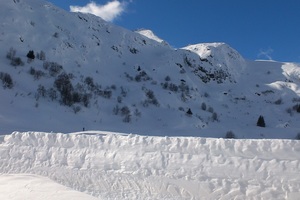
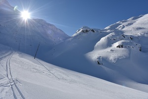
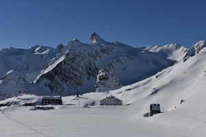
- The snow world of Grand-Saint-Bernard (c) nupursworld.com
Apart from the markers the path is not maintained and therefore mostly not nice and flat so that you have to get used to walking along a (sideways) slanting surface. This is where adjustable trekking poles come in handy because you can make the one on the downhill side a bit longer and the other one shorter for better balance. However, if there are flat stretches, do take advantage of them as walking on a sloping surface can get a bit strenuous after a while.
After the mushroom the wind conditions usually ease and the hike turns more pleasant and also less steep – for a while. After passing yet another, smaller, concrete dome you can get a first glimpse of a cross on a rocky outcrop and, Yes, it is not just a random cross but approximately marks your destination. The goal is nigh! The second concrete structure marks about two thirds of the way.
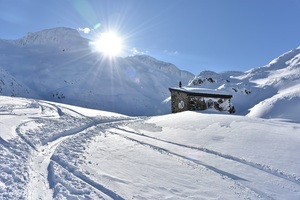
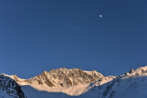
A small stone shelter is the last landmark before the steep, final ascent towards the pass which will take you about thirty minutes and has a quite dramatic feel to it due to the backdrop of the imposing and frighteningly named ‘Mont Mort’ (the mountain of the dead) which apparently refers to the many lives lost here to avalanches over the centuries.
If you really know what you are doing and you feel like a bit of a challenge, you can also take a side stroll here and walk in South-Easterly direction towards the valley of the Combe de Barasson. Add at least another hour for this more difficult WT2 detour. Otherwise follow the markers to the Col and enjoy the occasional glimpse of the growing monastery buildings for much appreciated boosts in morale.
- The last landmark before touchdown at the Col (c) nupursworld.com
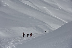
- The slopes towards Col du Grand-Saint-Bernard are not as lonely as one might think (c) nupursworld.com
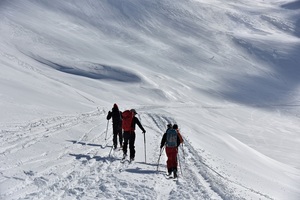
- Tour skiers overtaking me somewhere during the first half of the hike (c) nupursworld.com
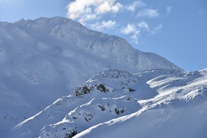
- Quickly leaving behind ‘Death Mountain’ on the last meters before reaching Col du Grand-Saint-Bernard (c) nupursworld.com
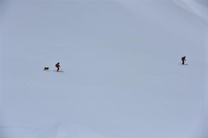
- The thrill of snow is also also great fun for pets (c) nupursworld.com
The pass greets you with the same serene silence you could not overhear to during the walk. There is nothing but the crunching of the snow under your shoes and your own breathing and heart beat. People do not come here for thrills. Yet, you will by far not be alone. On a fine weekend maybe one or two hundred people make it up to the pass, but they are typically not the crowd you might be used to from mainstream ski resorts. A good mix of no-frills people congregate at the Col. Families experiencing unbent nature with their kids and dogs, groups of sporty young people looking for adventure but also middle-aged battlers working to keep up their shape and curiosity as well as tours headed by professional mountain guides. Most hikers and skiers are ‘locals’ from the nearby French speaking parts of Italy and Switzerland as well as France proper although this winter hike is something of a celebrity in the European winter sports community. Watch the BBC clip embedded below to take in some of the fanfare surrounding it.
A road long traveled
Historically, you are in great company taking an interest in this pass. As the shortest connection between lands North and South of the Alps the area has been of strategic importance to the likes of Caesar, Augustus and Napoleon. Traders and pilgrims (on the Via Francigena connecting Canterbury and Rome), of course, also used it and it was for their sake that the archdeacon of Aosta, Saint Bernard de Menthon, had the hospice built in about 1050 to provide refuge for travelers who fell ill during their journey, were attacked by robbers or simply sought shelter from harsh weather. Saint Bernard has since been proclaimed the patron saint of the Alps and you can admire his giant statue at the Italian side of the pass lake which is frozen solid in winter and can be easily crossed.
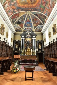
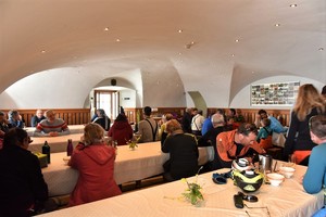
To this day, there is no lock at the front entrance of the hospice building which is run by a small group of Augustine monks year-round. Everyone is invited to a cup of warm tea and a chat with one of the monks in attendance and many chose to stay overnight to explore the pass area or to use the hospice as a base for more challenging ski tours and snowshoe hikes. For room reservations call +41 27 787 1236 (Monday to Saturday 10:00 – 11:30 and 16:00 – 17:00) or use their online form (which also contains prices). Remember, however, that this is a monastery, not a hotel, so, for example, meals are only available at set times.
For my part, I chose to return the same day. Maybe not my finest idea.
- Beware of falling icicles (c) nupursworld.com
- Looking towards the Italian side of the frozen pass lake (c) nupursworld.com
- Getting late when returning to Bourg-Saint-Bernard (c) nupursworld.com
- A jug of hot herbal tea for travelers coming in from the winter cold is a tradition at Hospice du Grand-Saint-Bernard (c) nupursworld.com
***
Good to know:
- Fitness: average
- Difficulty (on the scale for snowshoeing (“winter trekking”) WT1): low
- Starting point and car parking: Bourg-Saint-Bernard (N45.90018, E007.19584) at the beginning of the Grand-Saint-Bernard tunnel on the Swiss side
- Timing: 3 hours up, 2 hours down
- Elevations: you start at 1930 m and climb to the pass at 2440 m covering a difference of about 500 m
- Highlights: the exhilaration when reaching the hospice (monastery) building; the deafening silence during the walk
- Best time: any time in winter i.e between December and March, weather permitting
- Recommended equipment (apart from snowshoes and suitable hiking boots): extendable trekking poles (with large snow baskets), suitably warm and weather tight clothes, sun glasses, a backpack for food and drink, headlights (if there is a chance that you walk after sunset)
- Food & drink: apart from whatever foodstuffs you like and can be transported in a backpack, bring something sweet for a quick energy boost and at least one liter of drink per person; keep in mind that the backpack and contents can literally freeze stiff!
Remember that high alpine areas are potentially dangerous due to rough terrain and highly volatile weather. We are happy to share our experiences, but of course do not take responsibility for whatever you are up to.
